Our Natural Blue Spaces Interactive Map

Co-created interactive map exploring Central Bedfordshire waterways, through a blend of art, workshops and community participation.
2024 | Bedford Creative Arts, Bedfordshire, UK.
An interactive and co-created map that explores and celebrates Central Bedfordshire waterways.
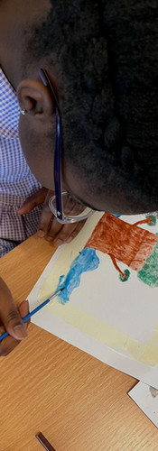
Working with Bedford Creative Arts, artist Kremena Dimitrova and Bedfordshire schools to produce an illustrated interactive map of their local natural blue spaces: River Ivel, Great Union Canal, Rushmere Park, and River Lea. Our Natural Blue Spaces is a project dedicated to exploring and celebrating the beauty of Blue Spaces (rivers, lakes, canals, and ponds) in Central Bedfordshire through art, co-creation, and community engagement.


Project dedicated to exploring and celebrating the beauty of Blue Spaces (rivers, lakes, canals, and ponds).
Workshops and outdoor activities enabled students and families to record their findings, which we then transformed into a digital memoir and a charter to protect blue spaces. These outcomes document the journey and discoveries of local communities, blending art, education, and environmental advocacy.
Behind the scenes:
Schools that took part are Southcott Lower School, Edward Peake Middle School, Parkfields Middle School and Thornhill Primary School.


The project is funded by Central Bedfordshire Council and Arts Council England in collaboration with The Greensand Trust, Canal and River Trust, and the Wildlife Trust.